Advantages of WFS links
The concept of using WFS (Web Feature Service) links in Geographic Information Systems (GIS) enables real-time access and manipulation of geospatial data via the internet.
- WFS is a standardized protocol that allows users to query, filter, and retrieve specific geospatial data from a remote server, such as GeoServer.
- Unlike simple data downloads, WFS enables dynamic interaction with the data: users can query datasets in real time.
- This centralized approach promotes more efficient data management, better collaboration among users, and reduces the need for local storage while ensuring that all users work with the most up-to-date and consistent information.
ArcheoBase facilitates the export of data via WFS links. This feature will automatically export the data entered in ArcheoBase forms directly into QGIS or ArcGIS, and to link this data to the geometries provided through our WFS service.
Obtaining WFS links in ArcheoBase
All Topo Points of the intervention can be displayed by clicking the  icon.
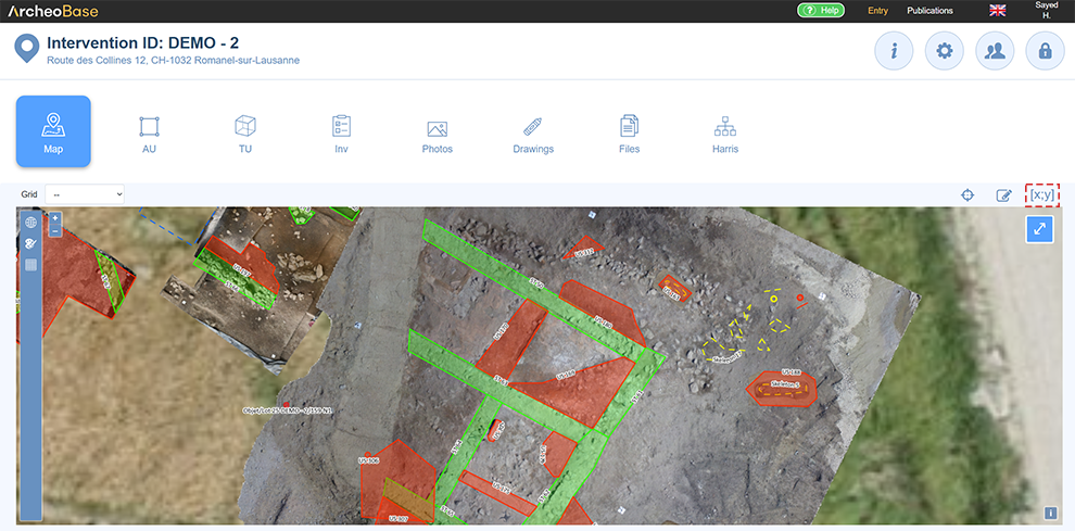
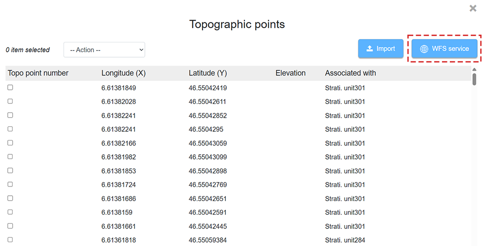
Then click the  button to open the WFS connection links window to the GeoServer.
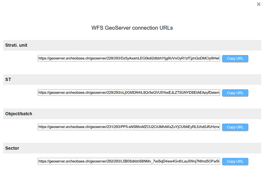
Each form type has a WFS link, which is a URL. This link must be copied into the target program. A demonstration is provided using QGIS.
To select these properties in ArcheoBase, you now have a “Configuration” button inside the popup that provides the WFS service URL. In the popup that opens, simply choose the properties you want to transmit.

Example of WFS link integration in QGIS
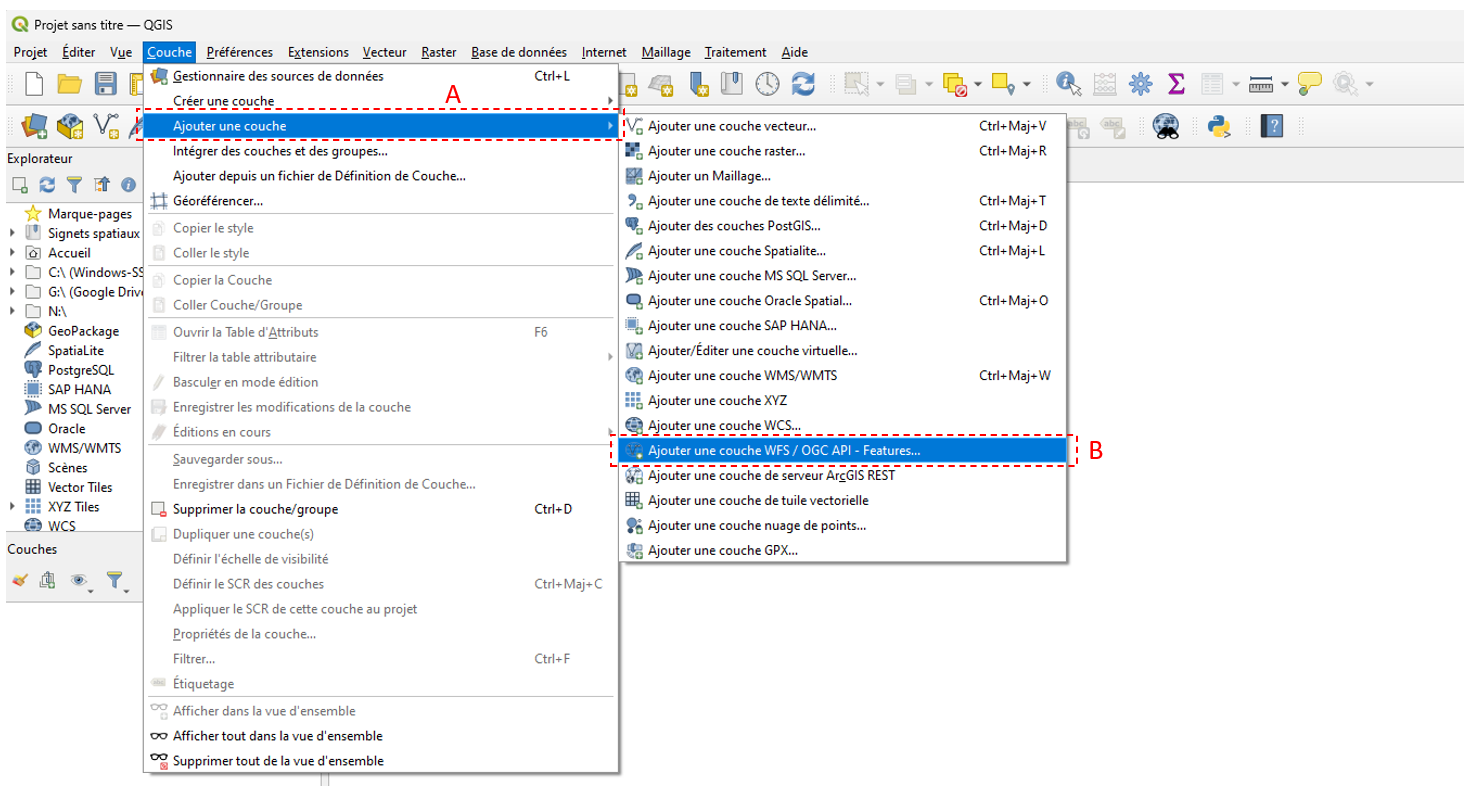
Open the Layer (A) menu and add a WFS / OGC API – Features Layer (B):
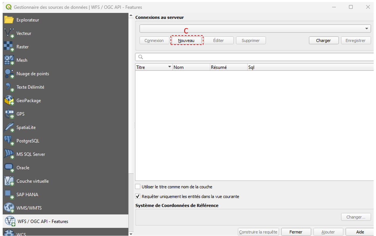
Establish a new server connection (C):
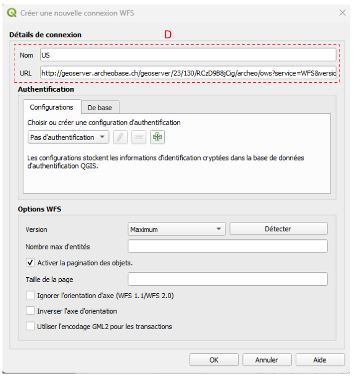
Enter the desired name for the new layer and paste the WFS link copied from ArcheoBase (D). It is important to also select the version OGC API – Features:

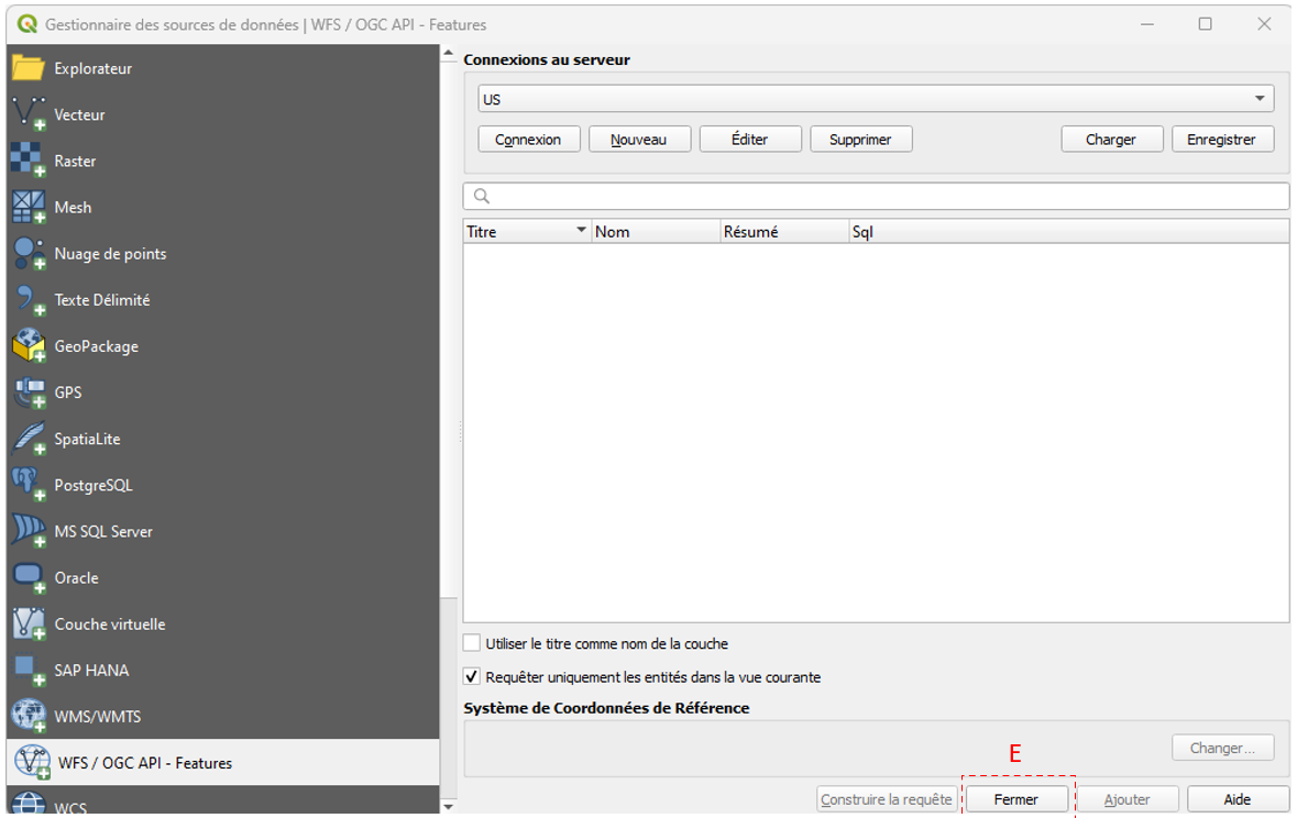
A new connection can be established, or you can finish the process by clicking Close (E):
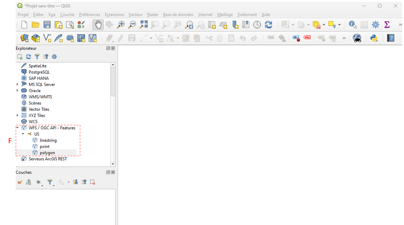
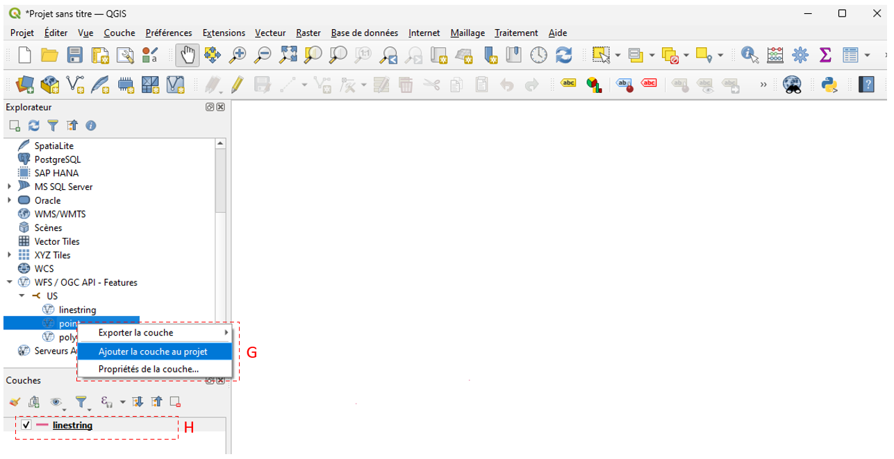
The connection and the different geometries made available by it are displayed on the left side of the map (F):
Next, add the layer to the project (G), and it will appear in the layers panel (H):
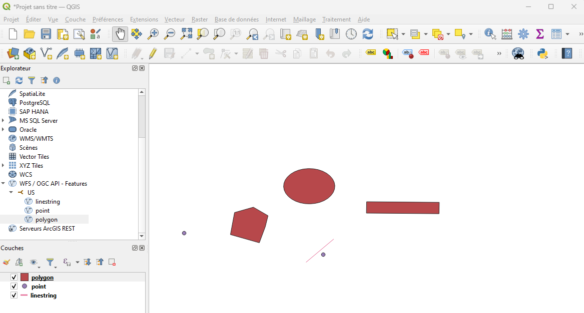
Once the connection is set and the layer is added, you will also find the selected properties in the attribute table. The “Line and Point” geometries used in ArcheoBase to represent map drawings and their orientation will be available in the WFS service as simple lines.
